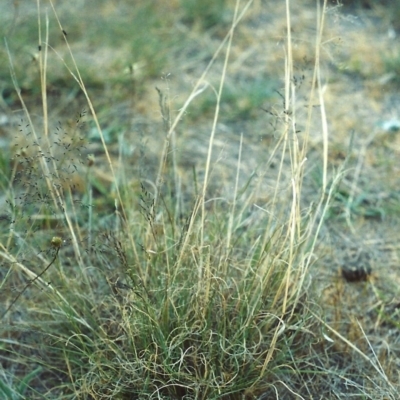
Eragrostis curvula (African Lovegrass)
Pest Plant.
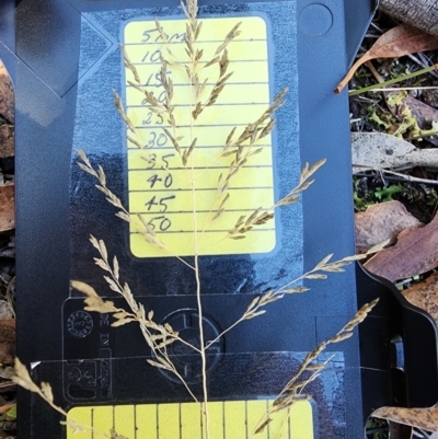
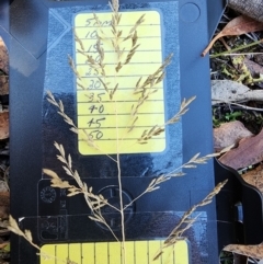
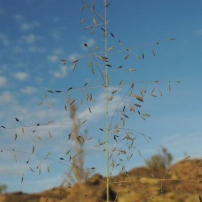
The curling tip to the leaves and the 30cm long brached grey-green to purplish-grey seed head, with small yellow to brown seeds are its most distinctive features.
Leaves are 20 -35cm long, 3-5mm wide, blue-green to dark-green, rough to touch (running down towards the base), margins may be rolled in, the tip is usually bleached and curled. Sheaths are hairy, typically straw coloured to purplish. The ligule is a ring of hairs than 2mm long.
African lovegrass can germinate at any time of the year but typically it will germinate in autumn or spring when moisture is sufficient and temperatures exceed 10°C. Growth of seedlings is relatively slow for the first six weeks. Flowering can occur from early summer and ripe seeds may be present from January to March. In coastal regions the plant can flower all year, but this occurs predominantly in the warmer months.
Seed has an inherent dormancy, which is broken after 5–6 months. Seed germination declines with age; however some seed can remain viable for up to 17 years.
Seeds germinate slowly and the plants have poor seedling vigour, making them susceptible to competition from other pastures species, or shading form trees.
Plant growth slows when temperatures decline in autumn and winter. Although the plant is susceptible to frosting it remains alive and will regrow again as temperatures increase.
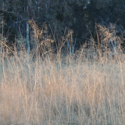
Seed spread is enhanced by drought conditions and over-grazing. Paddocks with low ground cover are more susceptible to invasion.
Further references: Agriculture Victoria
Eragrostis curvula is listed in the following regions:
Canberra & Southern Tablelands | Southern Highlands | Albury, Wodonga | South Coast | Hume | Townsville
Species information
- Eragrostis curvula Scientific name
- African Lovegrass Common name
- Not Sensitive
- Exotic
- Major weed or pest
- Up to 1047.79m Recorded at altitude
- 338 images trained Machine learning
-
In flower
- External link More information
Location information
-
Maps
Ainslie volcanic grassland Albury Alpine Shire ANU Baldessin Precinct Aranda Bushland Australian National University Banksia Street Wetland Corridor Bibbenluke Common Blue Gum Point to Attunga Bay Bluetts Block (402, 403, 12, 11) Bruce Ridge Bruce Ridge to Gossan Hill Budjan Galindji (Franklin Grassland) Reserve Bullen Range Central Molonglo City Renewal Authority Area Coombs Ponds Cotter Reserve Crace Grasslands Dickson Wetland Corridor Dryandra St Woodland Dunlop Grasslands Eight Mile Creek Eurobodalla National Park Farrer Ridge Flea Bog Flat to Emu Creek Corridor Flea Bog Flat, Bruce Ginninderry Conservation Corridor Gordon Pond Goulburn Mulwaree Council Griffith Woodland Gungaderra Grasslands Haig Park Harcourt Hill Higgins Woodland Hill Reserve Hughes Garran Woodland Hughes Grassy Woodland Isaacs Ridge Isaacs Ridge and Nearby Isabella Pond Kama Lake Burley Griffin West Lake Ginninderra Legacy Park Woodland Reserve Little Taylor Grasslands Marsden Weir Park Riverside Park Mawson Ponds Melrose Molonglo River Reserve Monash Grassland Mount Ainslie Mount Buffalo National Park Mount Jerrabomberra Mount Majura Mount Painter Mount Taylor Namadgi National Park North Tura Coastal Reserve Oakey Hill Paddys River Pine Island to Point Hut Piney Ridge Point Hut Hill Point Hut Pond Point Hut to Tharwa Red Hill Nature Reserve Red Hill to Yarralumla Creek Rob Roy Range Scrivener Hill Shoalhaven Heads Bushcare Simpsons Hill Stirling Park Stone Wall Paddock Sullivans Creek, Turner Terranna TSR The Fair, Watson The Pinnacle Thurgoona Golf Course Tuggeranong Creek to Monash Grassland Tuggeranong Homestead A.C.T. Umbagong District Park Upper Stranger Pond Uriarra Recreation Reserve Watson Green Space Wingecarribee Local Government Area Wollondilly River Corridor & Walkway, Goulburn -
Places
Chisholm, ACT Crace, ACT Evatt, ACT Gordon, ACT Goulburn, NSW Hackett, ACT Higgins, ACT Isaacs, ACT Jembaicumbene, NSW Kambah, ACT Nicholls, ACT O'Connor, ACT O'Malley, ACT Page, ACT Phillip, ACT Porcupine, QLD Theodore, ACT Tirrannaville, NSW Watson, ACT


